
Country
France
Locality
Nord
Identified Casualties
294
Visiting Information
Wheelchair access to the cemetery possible via main entrance. For further information regarding wheelchair access, please contact our Enquiries Section on 01628 507200.
Local Information
Denain is a town in the Department of the Nord, next to Valenciennes on the road and motorway towards Cambrai. The Communal Cemetery is situated in the north-east corner of the town approximately 1.2 kilometres from the town centre on the D40, following the route to Oisy and the Lycee A Kastler. The Cemetery will be found at the centre of a junction 20 metres from a traffic light controlled crossroads (D40 and D240). The CWGC plot will be found in the centre of the cemetery.
Historical Information
Denain was a German hospital centre during the greater part of the War; and from the 1st November, 1918, to the 12th March, 1919, the 33rd Casualty Clearing Station was posted in the town. The Communal Cemetery, was used by the Germans to bury their soldiers and (in 1917 and 1918) 153 British prisoners. A British plot was made at the South-East end, after the capture of the town; and after the Armistice the graves of the prisoners and other British graves were regrouped beside it. There are now over 300, 1914-18 war casualties commemorated in this site. Of these, over ten are unidentified and special memorials are erected to four United Kingdom and three Canadian soldiers, buried in the German plots, whose graves could not be found. The British plot covers an area of 777 square metres.
Cemetery Photo
Click the thumbnail below to view a larger image.
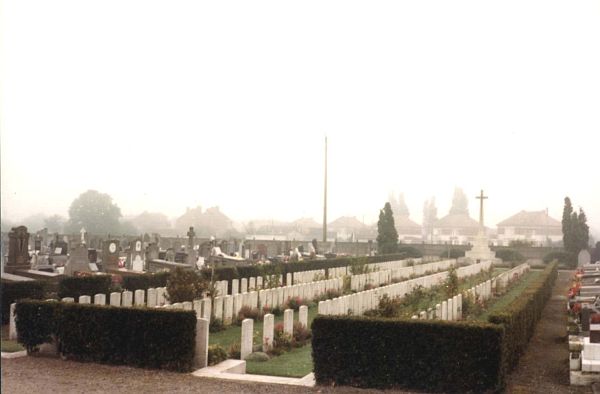
CWGC Cemetery Photo: DENAIN COMMUNAL CEMETERY
Cemetery Plan
Click the thumbnail below to view a larger image.
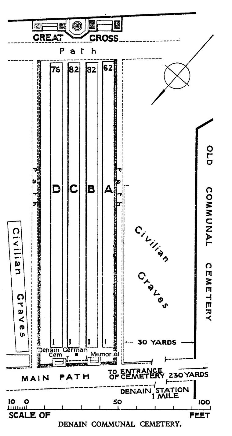
CWGC Cemetery Plan: DENAIN COMMUNAL CEMETERY

